Cities are bustling environments where the movement of people and goods is essential for daily life, yet managing this flow can prove challenging. Issues such as traffic congestion, delayed public transportation, and air pollution are prevalent and can significantly impact the quality of life. To address these challenges, transportation big data serves as a vital resource, akin to a comprehensive toolbox brimming with actionable insights.
Why Would A City Need Transportation Big Data ?
Collecting extensive transportation data from various sources, such as GPS devices, traffic cameras, and public transit schedules, allows cities to analyze patterns in transportation usage. This analysis offers a clearer understanding of peak traffic times, frequent congestion hotspots, and public transportation efficiency. With this valuable information, urban planners and transportation officials can implement data-driven strategies to optimize traffic flow, enhance the reliability of bus and train services, and develop initiatives aimed at reducing emissions.
For Example
Adjusting traffic light sequences in real-time based on current conditions can alleviate bottlenecks. Predictive analytics helps anticipate transportation needs, allowing for better infrastructure planning. This use of transportation big data keeps roads clear and public transport on schedule, contributing to a cleaner, healthier urban environment for residents.
Top 10 Types of Transportation Data
Here are the 10 types of transportation data every city needs to make things run smoothly:
1. Traffic Flow Data
Traffic flow data is like a live map of how cars move around a city. It shows where roads are busy, how fast cars are going, and how long trips take.
Role in Reducing Congestion
Cities like Los Angeles need to use congestion management tools to keep traffic moving. They collect data to see when and where roads become crowded. This information helps them adjust traffic lights, add extra lanes for carpoolers, or suggest different routes during busy times. These strategies help decrease traffic jams, save fuel, and make driving less stressful.
Use in Real-Time Navigation Apps
Route navigation apps like Google Maps and Waze use traffic management data to help drivers avoid busy roads and get to their destinations faster. This data also helps city planners figure out which roads need fixing or more space to handle traffic better.
2. Public Transit Data
Urban mobility big data from buses, trains, and subways tells cities how people use public transit. It shows who’s riding, when, and how well the system works.
Passenger Demand and Scheduling
Transit teams collect info from tickets, passenger counts, and bus GPS to see which routes are busy. This helps them decide when to add more buses or trains and how to schedule them so people don’t wait too long.
Improving Commuter Experience
This data about public transit lets transit agencies share updates through apps or signs at stations, which lets the riders know exactly when their bus is coming. It also gives commuter behavior insights that outline why people choose certain routes. This helps cities make transit more convenient and friendly for everyone.
3. Road Safety and Accident Data
Every city wants fewer crashes and safer streets. Road safety and accident data help figure out where problems happen and how to stop them.
Identifying Accident-Prone Areas
Vehicle telematics data, police reports, and crash records show where accidents happen most, like risky intersections. For example, New York City’s “Vision Zero” program uses this data to fix dangerous spots by adding crosswalks or lowering speed limits.
Supporting Urban Safety Policies
This data about road accidents helps leaders make safety plans, like putting up better signs or adding speed cameras where needed. These changes make roads safer for drivers, bikers, and walkers.
4. Freight and Logistics Data
Moving goods like packages or groceries keeps cities running. Transportation planning big data tracks trucks and deliveries to make sure they get where they’re going.
Efficient Goods Movement
Delivery companies use data to check routes, loading times, and truck conditions. This helps them pick the fastest paths, save fuel, and cut costs, which is good for the planet too.
Reducing Delivery Delays
With online shopping booming, cities need deliveries to be quick. Mobility-as-a-service data helps companies spot traffic delays or roadblocks and change routes so packages arrive on time.
5. Parking and Curbside Management Data
Finding parking in a busy city like New York can feel like a treasure hunt. Smart city transportation data makes parking easier and keeps streets clear.
Smart Parking Systems
Cities like San Francisco use traffic sensor technology to find empty parking spots. Sensors send info to apps that guide drivers right to open spaces, saving time and reducing traffic from circling cars.
Reducing Illegal Parking Issues
Data on parking spots and time limits helps parking officers catch people parking where they shouldn’t, like in loading zones. This keeps roads open and reduces traffic jams caused by bad parking.
6. Environmental and Emissions Data
Clean air is a big deal for cities. Environmental and emissions data help track pollution and make cities healthier places to live.
Tracking Vehicle Pollution
Systems that monitor air quality check for pollutants like CO₂ or smoke from cars. When paired with traffic data, cities can find areas with bad air and create zones where only low-pollution vehicles can go.
Supporting Sustainable Transport Policies
Environmental and emissions data show whether previously implemented green transportation plans are working. It helps cities decide where they can add electric car chargers or promote buses to keep the air cleaner.
7. Ride-Sharing and Mobility Service Data
Ride-sharing apps like Uber, Lyft, and bike-sharing programs have changed how we get around. Smart mobility data solutions from these services help cities plan better.
Uber, Lyft, and Shared Bikes
Data from ride-sharing shows where people need rides most, helping cities adjust bus or train routes. Bike-sharing data shows popular biking spots, so cities can add more bike lanes where they’re needed.
Integration into City Transport Planning
This data about mobility and transport services helps mix ride-sharing with buses and trains for a smoother travel system. It makes sure all ways of getting around work together, so people can move easily across the city.
8. Pedestrian and Bicycle Data
Collecting and analyzing data on how many people walk or bike each day is important for making cities greener and more friendly for everyone. This information helps city planners understand how well current paths and bike lanes work. It also shows where improvements are needed, like safer crossings or more parks.
Walking and Cycling Infrastructure Planning
Cities like Amsterdam and Copenhagen use urban transportation analytics to track how many people walk or bike. This helps them build wider sidewalks, safer bike lanes, and better crosswalks.
Encouraging Eco-Friendly Commuting
Knowing where people walk or bike helps cities create campaigns to get more people to try it. Not to mention that walking and biking are great for your health and the environment, so it’s a win-win situation for everyone.
9. Infrastructure Condition Data
Roads, bridges, and tunnels that are constructed well keep cities moving. Data from sensors in these structures helps spot problems before they get big.
Road Maintenance Prediction
Intelligent transportation systems (ITS) check things like road vibrations or bridge stress to find wear and tear early. Fixing things early means fewer road closures and safer travel.
Avoiding Costly Repairs
Cities that use this data save tons of money by catching problems early. Spotting cracks in roads or bridges before they grow keeps everyone safe and roads last longer.
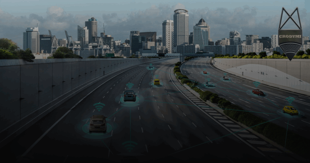
10. Autonomous and Connected Vehicle Data
Self-driving cars and trucks are here, and their data is helping cities get ready for the future.
Preparing Cities for Self-Driving Cars
Self-driving vehicles collect data from sensors and cameras to “see” the road. This helps cities understand how these cars use roads and plan for things like special lanes or signs.
Real-Time Communication Between Vehicles and Roads
Connected cars use GPS tracking for city planning to talk to roads in real time. They get updates about traffic lights or construction, making driving safer and faster.
If you wish to learn more about GPS and EDR, check out our blog on “EDR vs GPS Speed Accuracy: Which Data Wins in Accident Reconstruction.”
The Role of Big Data in Building Smarter Cities
Transforming Urban Mobility Through Data
Cities across the US use urban mobility big data to make transportation better. Every day, data from traffic sensors, cars, buses, and GPS helps planners see how people move. This lets them fix traffic jams, speed up buses, and make roads safer, all in real time.
Intelligent Transportation Systems (ITS): The Backbone of Modern Mobility
The USDOT (US Department of Transportation) pushes intelligent transportation systems (ITS) to make cities smarter. These systems use advanced tech to help roads and vehicles “talk” to each other. This system involves everything from traffic lights that change based on traffic, parking apps that find open spots, to cars that warn each other about hazards.
Building Sustainable and Connected Cities
Transportation big data helps cities go green. Here are examples of three major cities in the US:
- Places like Los Angeles use data to tweak traffic lights, cutting pollution.
- New York uses it to plan bike lanes, so fewer people drive.
- Chicago checks air quality data to make cleaner transit policies.
Such steps make these US cities nicer to live in and better for the planet.
Enhancing Safety with Data Analytics and Crash Investigation
When accidents happen, data from car recorders, cameras, and sensors helps figure out why. This lets engineers fix risky roads, add better signs, or enforce speed limits, keeping everyone safer.
The Growing Dependence on Urban Mobility Big Data
As cities grow, moving around gets harder. Smart city transportation data helps cities plan for buses, bikes, and deliveries. It catches problems early, like broken roads or late trains, making cities work better for everyone.
Partnering with Experts in Data-Driven Mobility
Building better cities takes know-how. Crodymi is a pro at turning data into smart ideas for cities and companies. We help make transportation safer and smoother, from figuring out crashes to pulling data from cars. Based in Texas but working worldwide, we’re all about using smart mobility data solutions to move cities forward.
To learn more about our advanced data extraction and analysis, explore:
- Infotainment Systems Data Extraction and Analysis
- Vehicle Data Retrieval ACM and ECU
- Scaled Drawings and Sketches
Conclusion
The best cities use data to make smart choices. Transportation big data gives planners the info they need to cut traffic, clean the air, and make buses and trains better. These 10 types of transportation data help cities stay safe, green, and easy to get around. As tech grows, good data keeps cities moving. Crodymi helps turn smart mobility data solutions into real results. Contact us to make your city safer and smarter!
Frequently Asked Questions
What is transportation big data?
Transportation big data is tons of info from things like traffic sensors and bus tickets. It helps cities make travel safer, faster, and greener.
How do cities use transportation big data?
Cities use types of transportation data to fix traffic, plan bus routes, check air quality, and make roads safer. It also helps with navigation apps and city planning.
Which type of transportation data is most important for traffic management?
Traffic management data is key to stopping traffic jams. It shows where cars pile up and helps cities adjust lights or routes.
Can big data improve public safety in cities?
Yes! Data on crashes, speeds, and walkers helps cities find dangerous spots and make roads safer for everyone.
How does big data support smart city development?
Smart city transportation data helps cities make smart choices, fix roads early, and use resources well for better travel.
What technologies help collect transportation data?
Cities use traffic sensor technology, GPS, connected cars, and cameras to get real-time info for planning.
How does big data affect environmental sustainability?
Transportation big data tracks pollution and pushes green travel, like biking or electric buses, to keep cities clean.
Why should cities invest in transportation analytics now?
With more people, cities get trickier to navigate. Urban transportation analytics helps plan for smart cars, better roads, and eco-friendly travel.